Activities guide
Point Danger Lookout: Lighthouse, Border Views and a Rainbow Bay Walk
By the ParadiseGrove editorial team · Last checked 12 September 2026
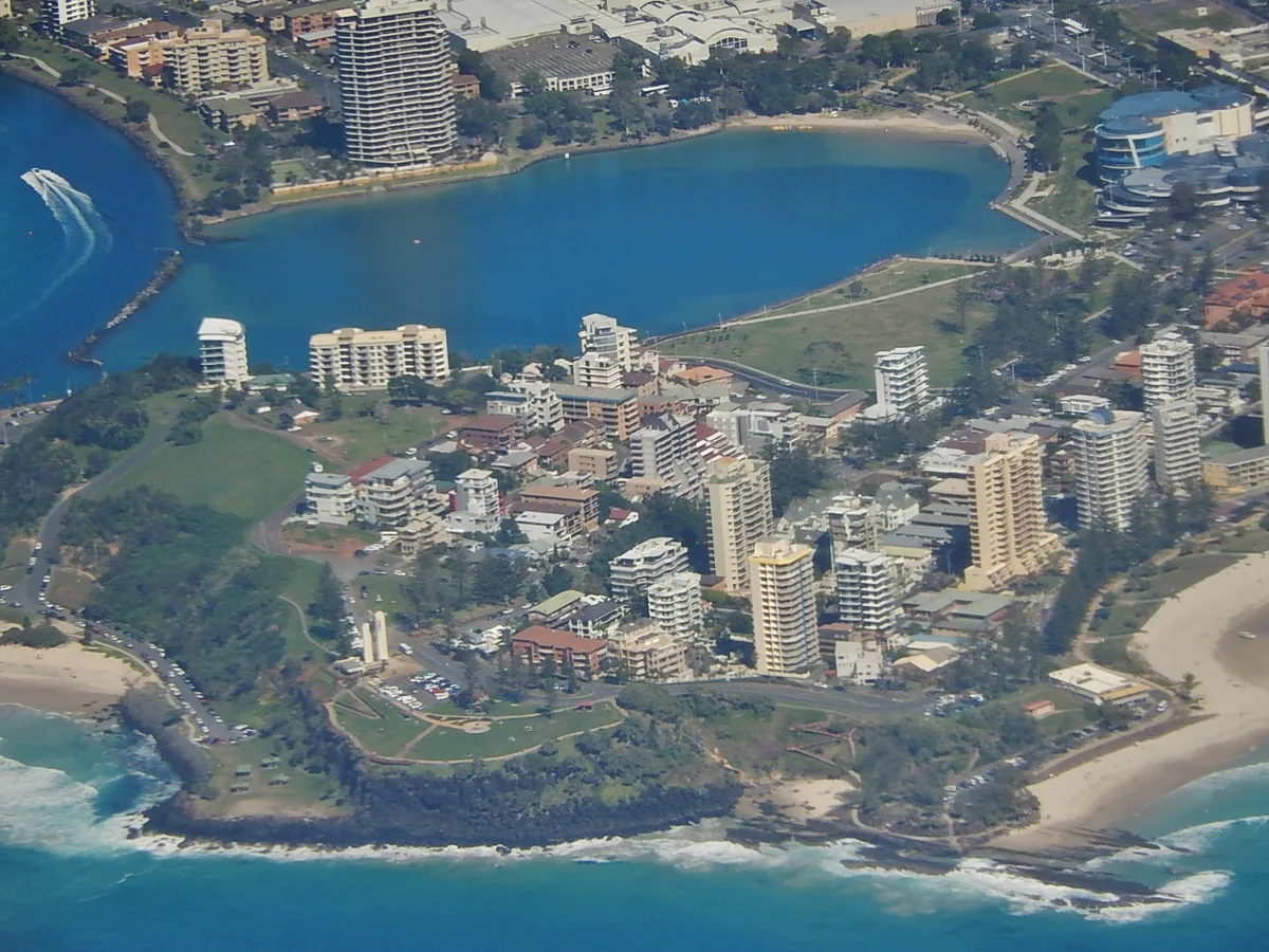
Point Danger is the headland finish to a Rainbow Bay walk: an elevated lookout where Queensland meets New South Wales, with the Captain Cook Memorial Lighthouse, ocean views and memorial stories in one compact precinct. Visit for 45 to 75 minutes if you arrive at the top, or make it a longer coastal outing by walking uphill from Rainbow Bay.
Why the headland earns more than a photo stop
From the precinct, the view opens south across Duranbah Beach towards the Tweed River entrance and north along the Gold Coast coast. That two-direction outlook is the reason to linger: first orient yourself towards the river mouth, then walk around the public viewing areas to see how Rainbow Bay and the built-up coastline sit on the other side of the headland.
The top is compact, so Point Danger works well when a mixed group wants a meaningful stop without a long bushwalk. Wind, glare and fast-changing coastal weather can make the exposed lookout feel very different from beach level. Bring water and sun protection, keep behind barriers near cliff edges, and avoid treating the rocks below as a shortcut.
Read the state border in the lighthouse
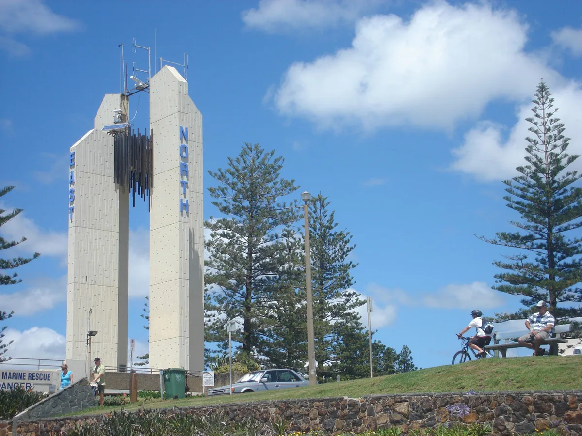
The Captain Cook Memorial Lighthouse stands across the Queensland–New South Wales boundary. Tweed Shire Council’s heritage inventory records the place as a memorial to James Cook’s 1770 voyage and as the starting point for the 1865 survey that established the border in this area. The memorial was officially opened in April 1971 after a joint project involving the two local councils and the Australian Government.
Walk around the exterior and look for the border markers rather than expecting a lighthouse-interior visit. The unusual border setting is the useful story here: you can move between the Coolangatta side and the Tweed side within the same headland precinct, while the tower gives the site a single visual centre.
Look for Ngagambi and the maritime memorials
The 2024 precinct upgrade added artworks and storyboards by Bundjalung artists Christine Slabb and Kyle Slabb. Tweed Shire Council says they tell the story of Ngagambi, the Black Dingo, the traditional name connected with the area. Read the installed interpretation in place; it offers cultural context from the commissioned artists without turning the story into a decorative aside.
The headland also carries a Walk of Remembrance with plaques for Allied naval and merchant ships sunk off the Australian coast during the Second World War. An anchor nearby commemorates merchant mariners. These elements make a slow circuit more rewarding than a single lookout photograph. Treat plaques, artworks and memorial spaces respectfully and keep children from climbing on them.
Walking up from Rainbow Bay
From Rainbow Bay, use the formed public paths and streets towards Boundary Street and the headland. The climb is the defining practical detail: it is short enough to add to a beach day, but it is still an uphill extension after the flatter Greenmount–Rainbow Bay coastal walk. Street crossings and the final approach matter more than the map distance.
Our two-to-three-hour allowance includes the return from Rainbow Bay, time at the lookout and stops for photographs; it is an editorial planning range, not a measured walking time. Turn around at Rainbow Bay if heat, fatigue or mobility makes the climb a poor fit. The new lookout building has a ramp to its top viewing deck and accessible toilets, but that does not make the entire route from the bay step-free. Check your particular starting point and access needs before setting out.
Parking, toilets, picnic space and the café
The precinct has public toilets, seating and picnic space. The 2024 upgrade added accessible amenities, a ramp to the building’s viewing deck, a café and 13 car spaces on the southern side. These improvements make it possible to arrive at the top and enjoy the lookout without walking up from the beach.
Parking is still finite and availability is not guaranteed. Read the current signs where you leave the car, including any time or overnight restrictions, and do not rely on an old photograph for the present layout. Black Dingo Café is in the renovated building and publishes its current menu and opening hours; check them on the day if a café stop is important rather than treating food service as guaranteed.
A sensible Rainbow Bay and Point Danger outing
For the fuller version, start at central Coolangatta, follow the coast around Greenmount to Rainbow Bay, pause near Snapper Rocks in the public viewing areas, then climb to Point Danger. At the top, make one circuit for the two coastal views, lighthouse, artworks and memorials. Return to Rainbow Bay for a picnic or a booked lunch instead of squeezing another distant attraction into the same half-day.
If the headland is your priority, reverse the plan: arrive at the top early, explore before the day becomes hotter, then descend towards Rainbow Bay only if the group wants more walking. Our Coolangatta and Rainbow Bay day guide covers the beach-level route, swimming cautions and lunch choices. Keep Point Danger as the elevated finish rather than repeating the whole outing here.
Getting there from Burleigh
From a Burleigh base, first decide whether you want to begin at Coolangatta Central for the complete coastal walk or go directly to the headland. Translink’s journey planner is the place to check the current public-transport itinerary and return leg; route descriptions can change. A car makes the top easier to reach, but it does not guarantee a space.
For a shorter southern outing with creek and beach choices, compare our Currumbin day guide. Point Danger is most worthwhile when the border, memorials and elevated outlook are part of the plan—not merely a box to tick between beaches.
Sources and planning links
- Tweed Shire Council — 2024 upgrade, access, facilities, views and commissioned artworks
- Tweed heritage inventory — lighthouse and border history
- Tweed Shire Council — Rainbow Bay to Point Danger walk and memorial details
- Tweed Regional Museum — the merchant-mariners anchor
- Experience Gold Coast — headland location and overview
- Black Dingo Café — current operator information
- Translink journey planner